RUOS Technologies
ESRI Field Maps Exporter
RUOS Technologies
ESRI Field Maps Exporter
Export attributes (CSV) and photo attachments from any ArcGIS hosted feature layer into a combined per-layer PDF, ready to download.
Stop wasting hundreds of hours researching how to extract attachments from ESRI Field Maps. Meet the platform that does it for you.
Life-changing technology
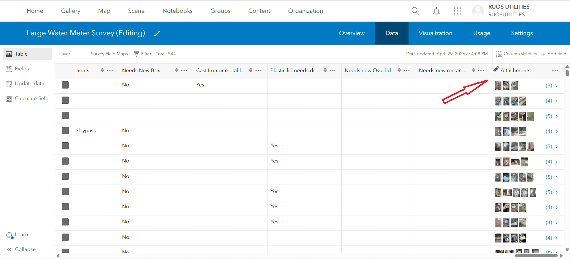
- Import Attachments from Field Maps
- Import CSV File from Field Maps
- Convert Attachments & Data into a combined PDF
- Keep all your project attachments in one place
- Store every attribute and photo in the cloud
- Download a polished PDF in one click
- Protected end-to-end so your field data stays safe
Everything you need to ship field data, end-to-end.
Import attributes, attachments and photos from your Field Maps layer and convert them to a per-layer PDF — one platform for every ESRI Field Maps project.
Attachments importer
Pull every photo attached to your ArcGIS hosted feature layer in a single sweep.
CSV from Field Maps
Export every attribute and field value straight from your Field Maps survey.
One combined PDF
Merge attributes + photos per layer into one polished, ready-to-share PDF.
Cloud workspace
Every project, every photo, every attribute — kept together in your workspace.
One-click download
No scripts, no toolboxes. Click once and your PDF is on your machine.
End-to-end protected
AES-256-GCM + TLS 1.3 keep your field data safe in transit and at rest.